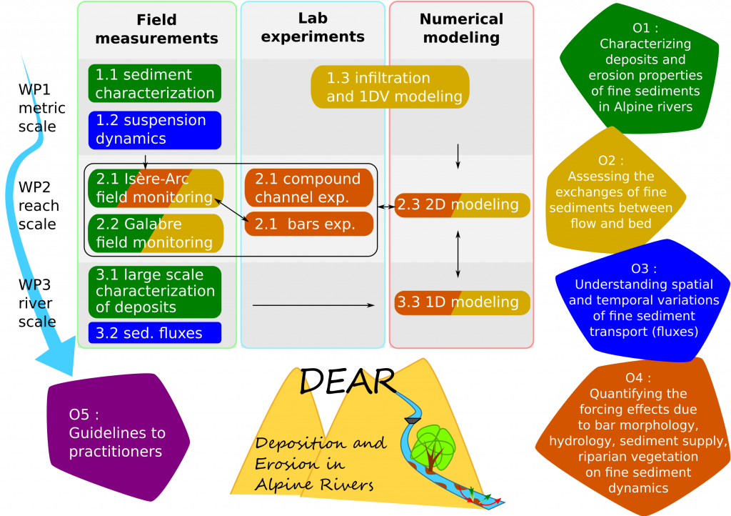
The project will be divided in four work packages (WP). The first three WPs correspond to the three main spatial and temporal scales as described previously. Each WP will be spread amongst laboratory and/or field experimental tasks closely linked to a numerical task, which will be used to summarize advances from experimental results and to provide some feedbacks to the experimental tasks. Results from local scale (WP1) will be used to better model the reach scale (WP2); and results from the reach scale will provide information to improve the larger scale modelling, i.e. WP1 to WP2, and WP2 to WP3. Conversely, the field observations at the river scale will obviously guide the choices of the processes we will study at smaller scales; the river model will also allow to provide boundary conditions to the reach scale model. The structure of the project is sketched in Figure 3. WP4 corresponds to the scientific coordination and dissemination.